Growing up in Anchorage, I literally know the Chugach mountains like I know every episode of the Office (embarrassingly well!). I know the peaks I always climb, the ones I’ve braved a couple times, and the ones I never have climbed and probably never will.
So, I broke down my favorite hikes. The easy hikes are hikes I would invite my aunt who is descent shape on. She’s afraid of heights. The medium hikes are the hikes I’d bring in-shape friends when I want to show off Alaska. The hard hikes are the hikes that I ain’t bringing anyone up unless I’m damn sure you can keep up with me and aren’t going to freak out at the steep sections. I hope that helps you figure out which category you’re in. No matter which hike you choose, I recommend that you review your bear safety before since there will likely be wildlife on these trails. And I highly recommend you check out this guide I wrote on traveling in Alaska. Please, feel free to get in touch with me if you have any personal questions. I hope you enjoy Alaska as much as I do.
Many of these hikes can be turned into a great overnight backpacking trip.
Note: Distances from Anchorage vary depending on your starting location. For many of these hikes, the Glen Alps / Flattop parking lot is a popular starting point, accessible by car or shuttle.
For shuttle information, check the Anchorage to Flattop Shuttle Service. They leave from 333 W Fourth Ave #206 at about 12pm and the van leaves the trailhead at 4pm. It’s not an amazing option, as it only gives you 3 hours of hiking time, but better than nothing. I highly recommend renting a car and I have some tips on how to get a cheap car rental in Alaska.
Map of the Chugach
I highly recommend you check out this map of the Chugach range. It has all of the locations I’m writing about.
What Gear Should I Pack?
You can check out this packing list for what to bring when day hiking in Alaska.
The Best Easy Hikes in Anchorage
Please recognize that “easy” in Alaska is not “easy” in the rest of the world. What classifies these as easy is that they’re on well-marked trails, don’t have serious inclines, and are fairly well traveled. You can check out my guide on walks and family-friendly hikes around Anchorage if that’s more up your alley.
In all fairness, there are shorter hikes in the Moderate section, but they have much steeper inclines and are harder on the glutes and knees. So if you prefer shorter and steeper, look in that section. The Easy section are longer in terms of mileage, but less steep.
In my opinion, these trails are suitable to do as a family if you have kids with good hiking abilities or a backpack to carry them in.
1. Flattop Mountain Overlook Trail
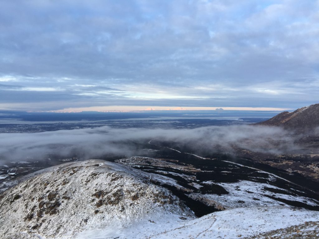
Flattop is the most famous of Anchorage hikes. It’s summit hike is also often attempted by those who underestimate its difficulty due to its popularility. Inevitably, every year a few people are medevacked off its side. Fortunately, there are two saddles you can hike to that are much easier.
You will park at the Glen Alps / Flattop parking lot and follow the signs to Flattop. The hike begins with a decent uphill, after which you will reach the first saddle and have an option to continue along the loop. If you feel like pushing yourself, you can reach the second saddle, which gives more dramatic views of the nearby peaks and valleys. A lot of this section is stairs that are eroding, so bring good shoes! I have had to personally rescue someone trying to do it in Vans.
On a clear day, you can see Denali rising up in the distance.
- Trailhead: Glen Alps / Flattop Trailhead
- Distance from Anchorage: Approximately 7 miles from downtown Anchorage
- Distance: 1.5 miles round-trip
- Time: 1-2 hours
- Elevation Gain: 400 feet
- Permit/Pass Required: Annual Alaska State Park Pass ($60) or Day-use parking fee ($5) at Glen Alps / Flattop Trailhead.
2. Rabbit Lake Trail
Rabbit lake is a gorgeous trial to an alpine lake. There is fish in the lake and you can fish, but you need appropriate licenses.
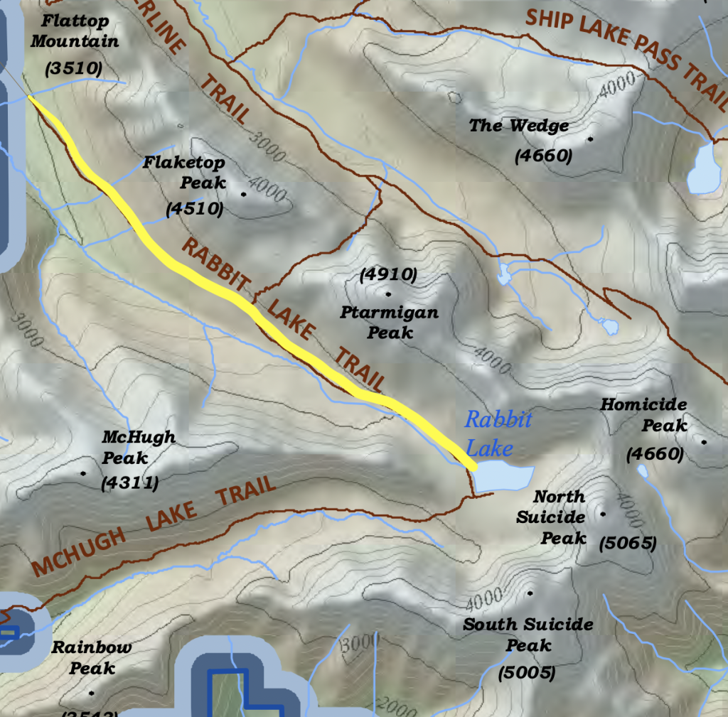
As you might see on the map, you’re actually hiking in the valley alongside the backside of Flattop. Some people actually like to take this trail and then cut up the backside of Flattop. There are many variations you can do, which is why I wrote this guide on understanding the Chugach.
The trail itself climbs steadily the entire time, but its only ever a moderate incline which makes it very doable. The lake itself is surrounded by North and South Suicide Peak and is absolutely stunning. Jump in for a swim if you’re brave enough.
This can also be turned into a much more difficult trail, where you peak South Suicide Peak. It is also perfect for an overnight backpacking trip.
- Trailhead: Rabbit Lake Trailhead
- Distance from Anchorage: Approximately 11 miles from downtown Anchorage
- Distance: 8.7 miles out and back
- Time: 4-5 hours
- Elevation Gain: 1,500 feet
- Permit/Pass Required: No special permit required, but make sure to park alongside the road, not at the trailhead.
3. Symphony and Eagle Lakes Trail
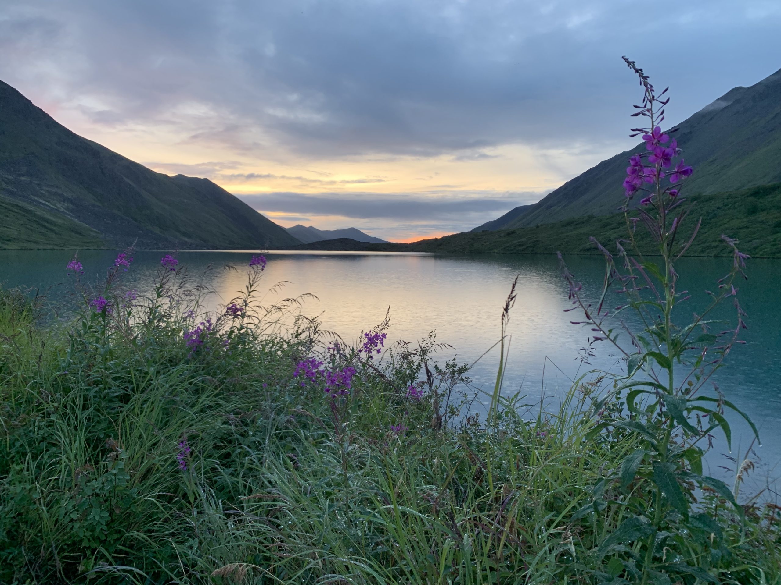
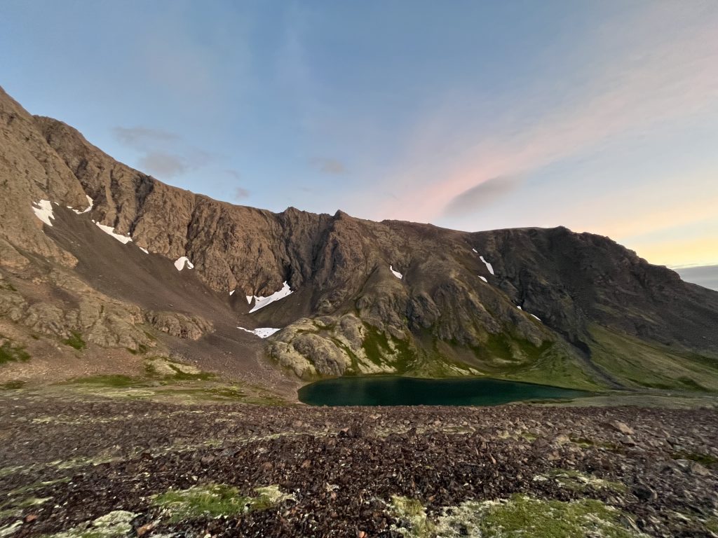
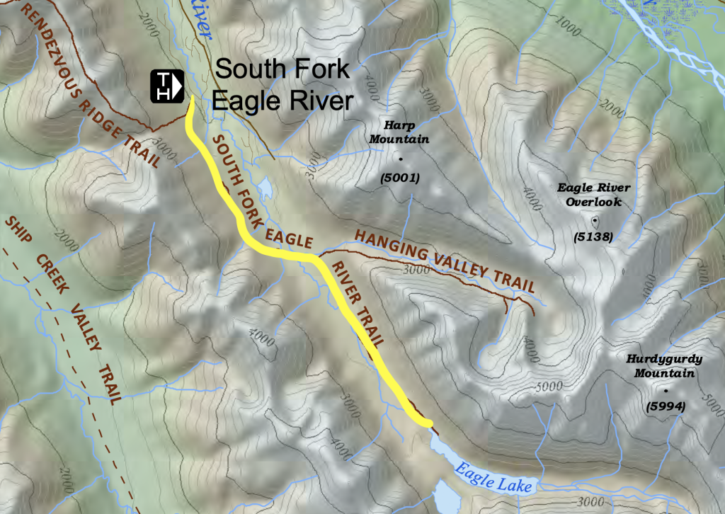
This is one of my favorite trails in Anchorage. It is fairly easy, with a moderate incline along the length of the trail. When you arrive, you’ll see two alpine lakes with the distinctive turquoise tint to them – Eagle Lake on your left and Symphony Lake on your right.
From here, you can summit Triangle Peak if you want more of a challenge. You can also pitch a tent for one of the prettiest camping spots in Alaska. I go over that in my best 2 day / 1 night backpacking trips guide.
- Trailhead: South Fork Valley Trailhead
- Distance from Anchorage: Approximately 8 miles from downtown Anchorage
- Distance: 9 miles out and back
- Time: 4-5 hours
- Elevation Gain: 1500 feet
- Permit/Pass Required: No special permit required.
4. Hidden Lake Trail
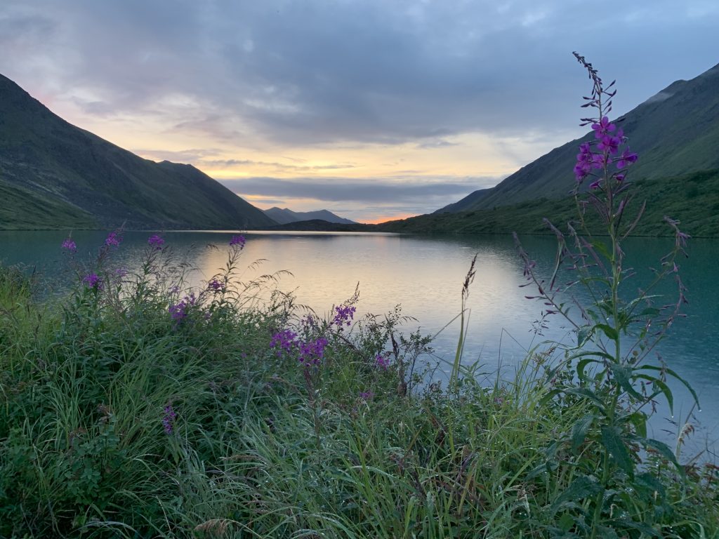
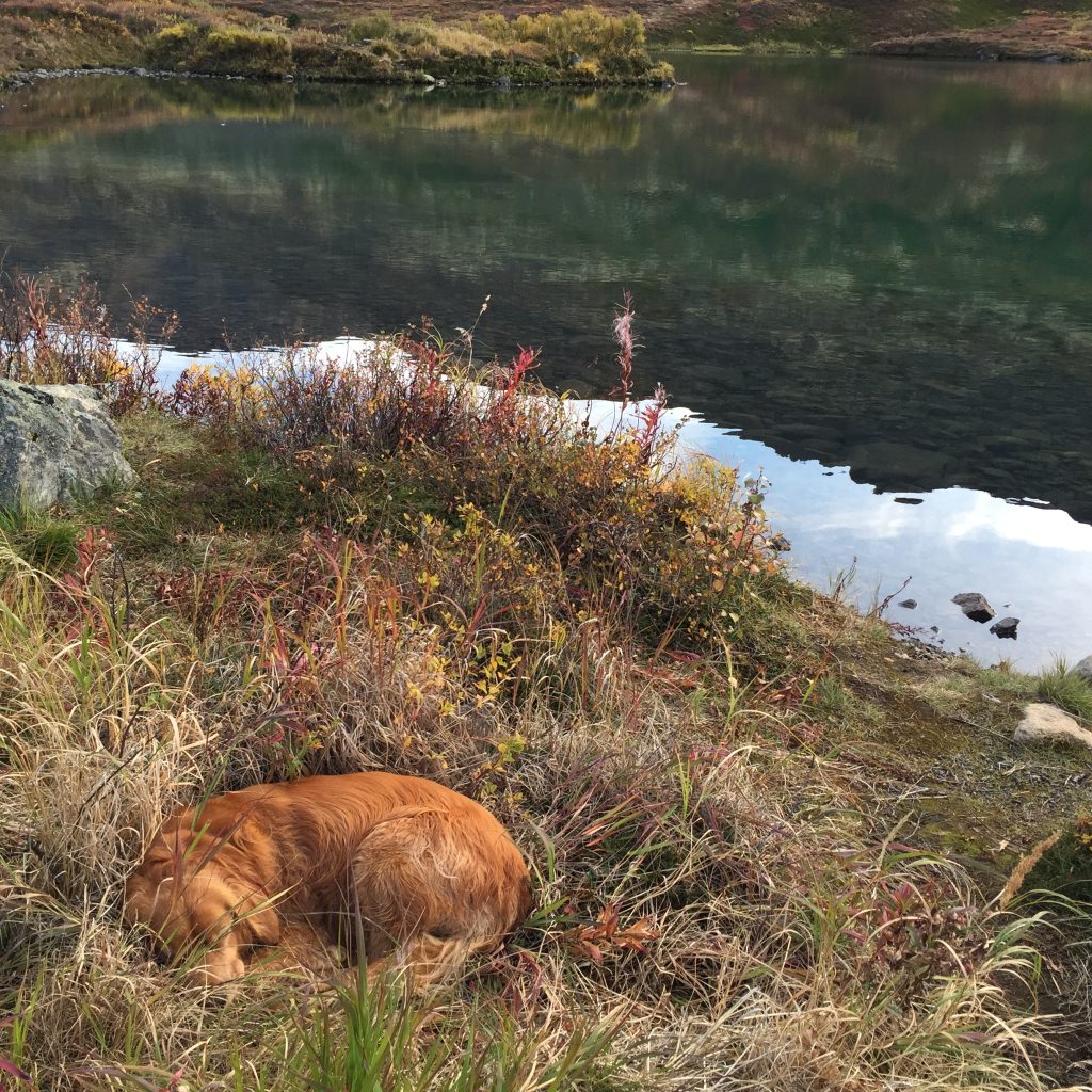
It’s called Hidden Lake because you will repeatedly think you are just about to arrive at the lake, only to find more ground to cover. You will likely conclude that the lake has dried up. That is not true. Keep going.
This is a great hike, although, honestly, I’d rather go to Rabbit Lake or Symphony Lake if I was doing a lake hike. Hidden Lake is tucked into Powerline Pass (the pass alongside Flattop) and set underneath The Ramp. Despite it not being my favorite, I have done it many times and enjoyed it every time.
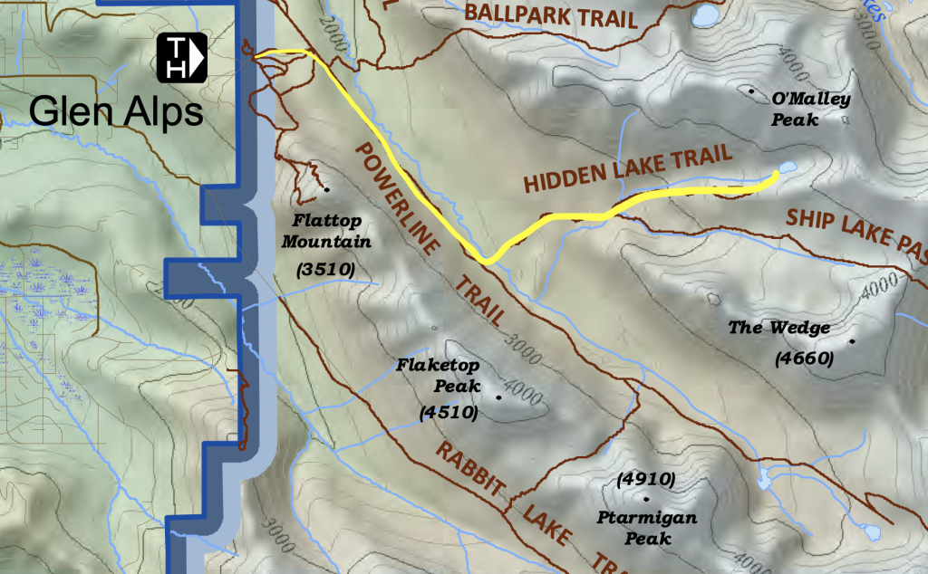
- Trailhead: Glen Alps / Flattop Trailhead
- Distance from Anchorage: Approximately 9 miles from downtown Anchorage
- Distance: 9 miles out and back
- Elevation Gain: 2000 feet
- Time: 5 hours
- Permit/Pass Required: Annual Alaska State Park Pass ($60) or Day-use parking fee ($5) at Glen Alps / Flattop Trailhead.
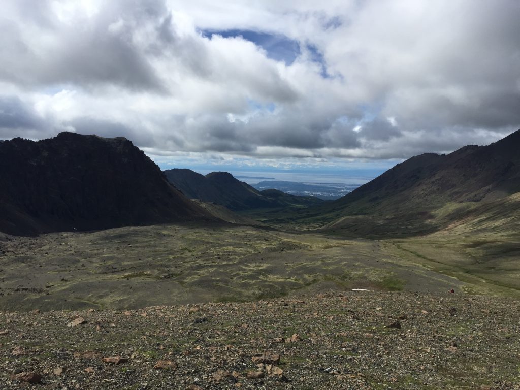
The Best Moderate Hikes in Anchorage
1. Little O’Malley Peak
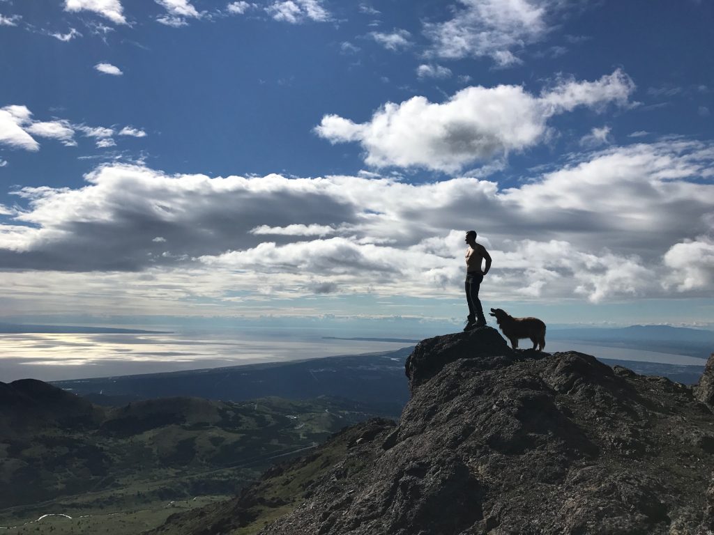
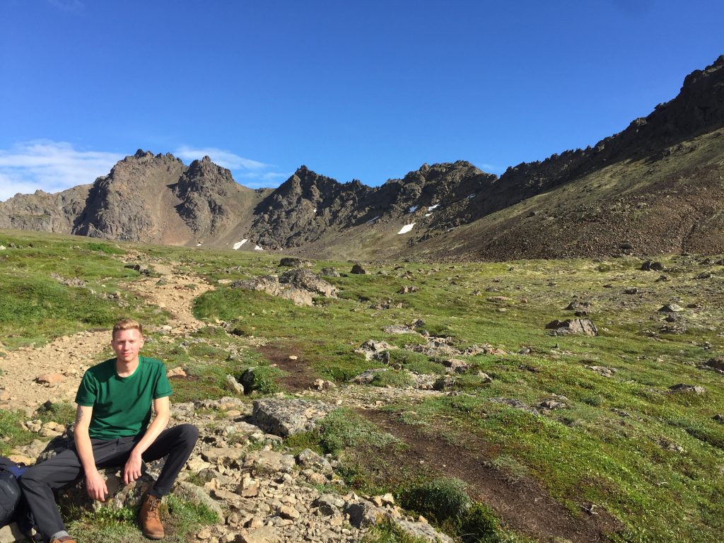
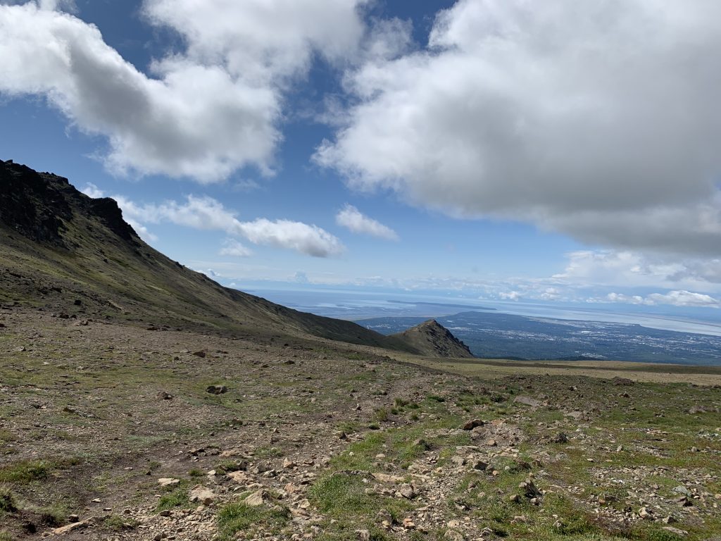
Little O’Malley is an epic hike with incredible views. It takes a series of switchbacks with a good elevation gain up to the peak, where you’ll see Anchorage stretching out in one direct and the Ball Fields in the other. I highly recommend this if you want a couple hour hike with views and you have the strength for it.
You can follow the trail through the Ball Fields (called because of the massive boulders in the field) and down past Williwaw Lakes to make it a loop if you want. Or you can climb Big O’Malley if you want a real challenge.
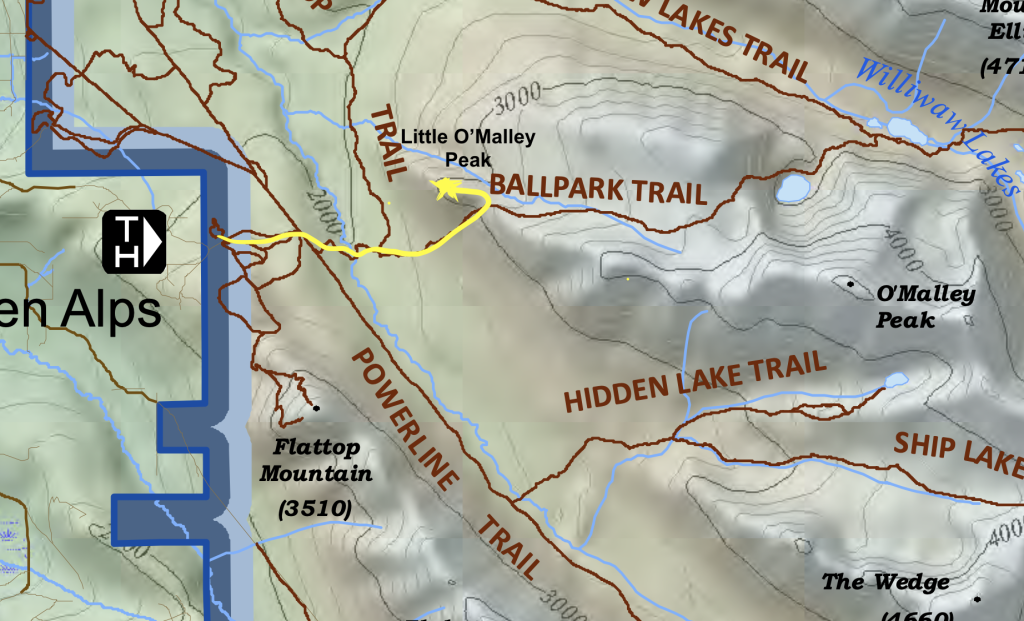
- Trailhead: Glen Alps / Flattop Trailhead
- Distance from Anchorage: Approximately 7 miles from downtown Anchorage
- Distance: 4.5 miles out and back
- Time: About 3 hours
- Elevation Gain: 1,500 feet
- Permit/Pass Required: Annual Alaska State Park Pass ($60) or Day-use parking fee ($5) at Glen Alps / Flattop Trailhead.
2. McHugh Peak
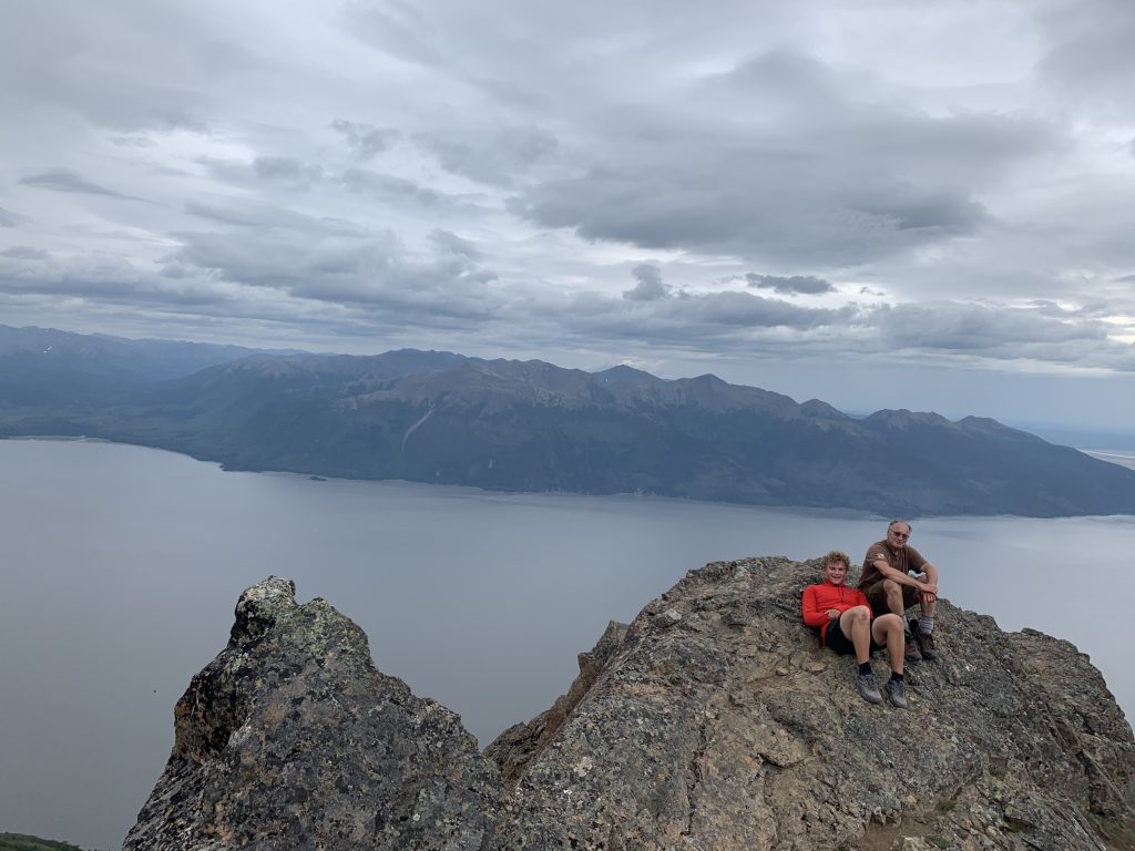
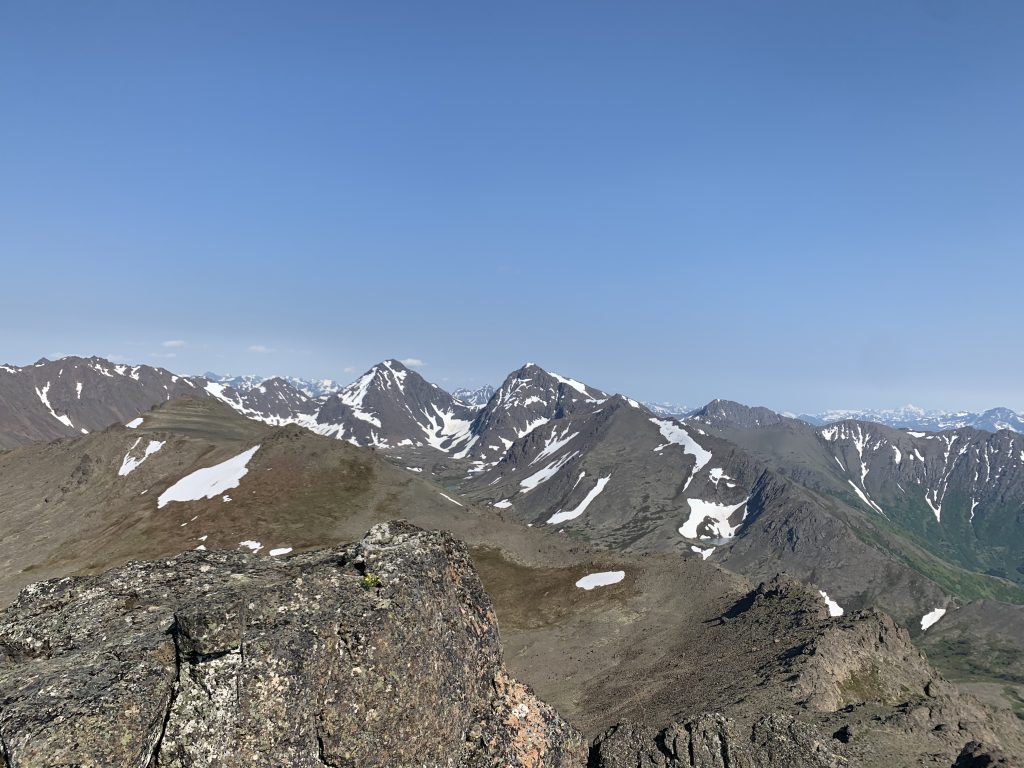
I love this hike, because much of it is along an incredible ridgeline that gives you views of the ocean along Cook Inlet. Truly, this is probably my favorite hike in Anchorage if I’m not feeling like killing myself physically. Note that the actual summit is on top of a huge boulder that requires a bit of bouldering to reach the actual top. This isn’t required, but it is fun.
I recommend starting this hike at the Bear Valley Trailhead. The issue here is that there are only about five parking spots. This is fine for a mid-weekday hike, but on a weekend or in the evening, this won’t work. You’ll have to park at the overflow parking lot a quarter mile away. The reason I like this option is because you get much more time on the ridge.
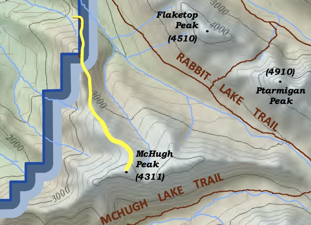
Alternatively, you can take it from McHugh Creek, which is major up and down hike with a lot more elevation gain (since you’re starting from sea level).
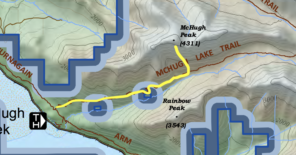
- Trailhead: Bear Valley Trailhead (AKA Honey Bear TH) or alternatively McHugh Creek Trailhead
- Distance from Anchorage: Approximately 13 miles from downtown Anchorage
- Distance:
- 5.6 miles out and back (from Bear Valley)
- 5 miles (from McHugh Creek)
- Elevation Gain:
- 2,300 feet (from Bear Valley)
- 4,300 feet (from McHugh Creek)
- Time:
- 4 hours (from Bear Valley)
- 6-8 hours (from McHugh Creek)
- Permit/Pass Required: Annual Alaska State Park Pass ($60) or Day-use parking fee ($5) at McHugh Creek Trailhead.
3. Williwaw Lakes
This is another gorgeous hike to two alpine lakes, tucked in the shadow of Big O’Malley (an iconic mountain and the largest in the Chugach front range. You can also summit Williwaw Peak, which makes for a very hard day hike or a great overnight trip. There are three options for this hike.
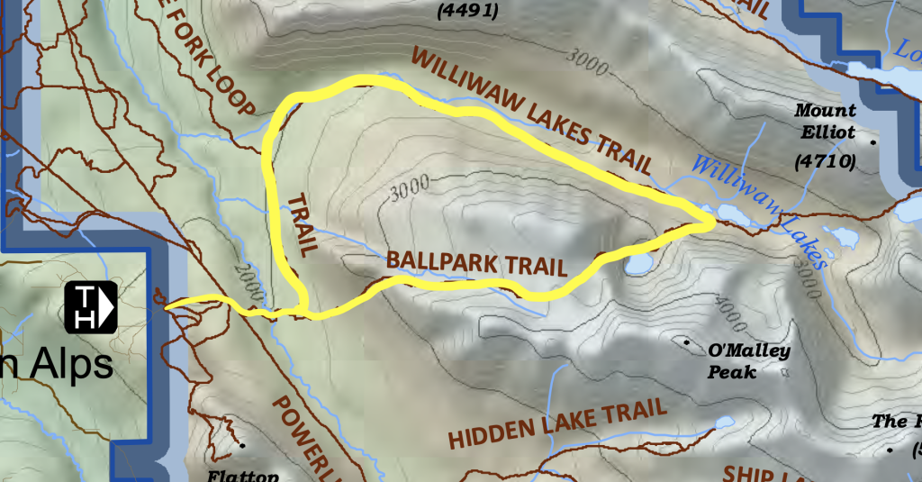
Option 1 – Williwaw Lakes and Ball Park Loop: The first is you start at the Flattop Trailhead and make a loop by following the ballpark trail up to Little O’Malley (I consider this a moderate climb, although it’s a pretty intense uphill). Then you walk through the ballfields until you start your descent down to the lake, and then and follow the loop back to the parking lot.
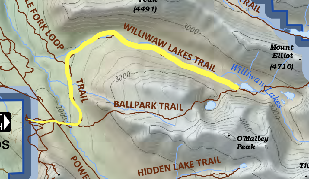
Option 2: The second is you start at the Flattop Trailhead and, instead of turning right and going up the ballpark trail, turn left and follow it to Williwaw lakes and head back. I would classify this trail as easy.
Option 3: Start at Prospect Heights Trailhead and follow the trail to Williwaw Lakes. I don’t recommend this option as the trail is in the lowland brush for about three miles and just unnecessarily adds distance.
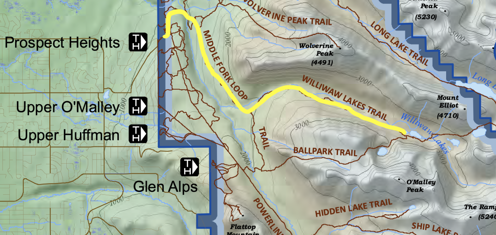
I would choose Option 1 if I was up for a climb and Option 2 if I wanted an easier hike.
- Trailhead: Glen Alps / Flattop Trailhead or Prospect Heights Trailhead
- Distance from Anchorage: Approximately 8 miles from downtown Anchorage
- Distance:
- Option 3: 10.1 miles loop
- Option 2: 11 miles out and back
- Option 3: 16.4 miles out and back
- Elevation Gain:
- Option 3: 2400 feet
- Option 2: 800 feet
- Option 3: 1,200 feet
- Time:
- Option 3: Unclear. I would estimate about 6 hours.
- Option 2: 8 hours
- Option 3: 7:30 hours
- Permit/Pass Required: Annual Alaska State Park Pass ($60) or Day-use parking fee ($5) at Prospect Heights Trailhead.
4. Rendezvous Peak
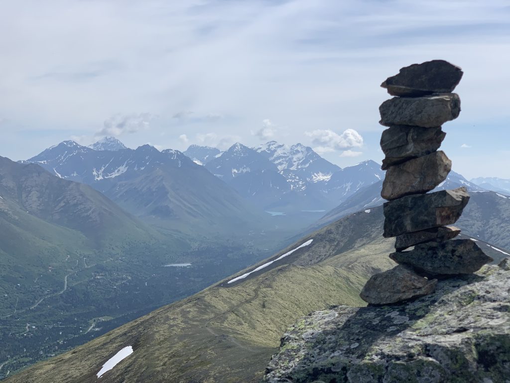
Hiking Rendezvous Peak via Arctic Valley is an awesome climb that gives you incredible views of Anchorage on one side and Eagle River valley on the other. This is a great climb if you want to gain some elevation, get great views, and not burn the whole day. You can always making it longer by climbing Mt. Gordon Lyon or following the ridge line.
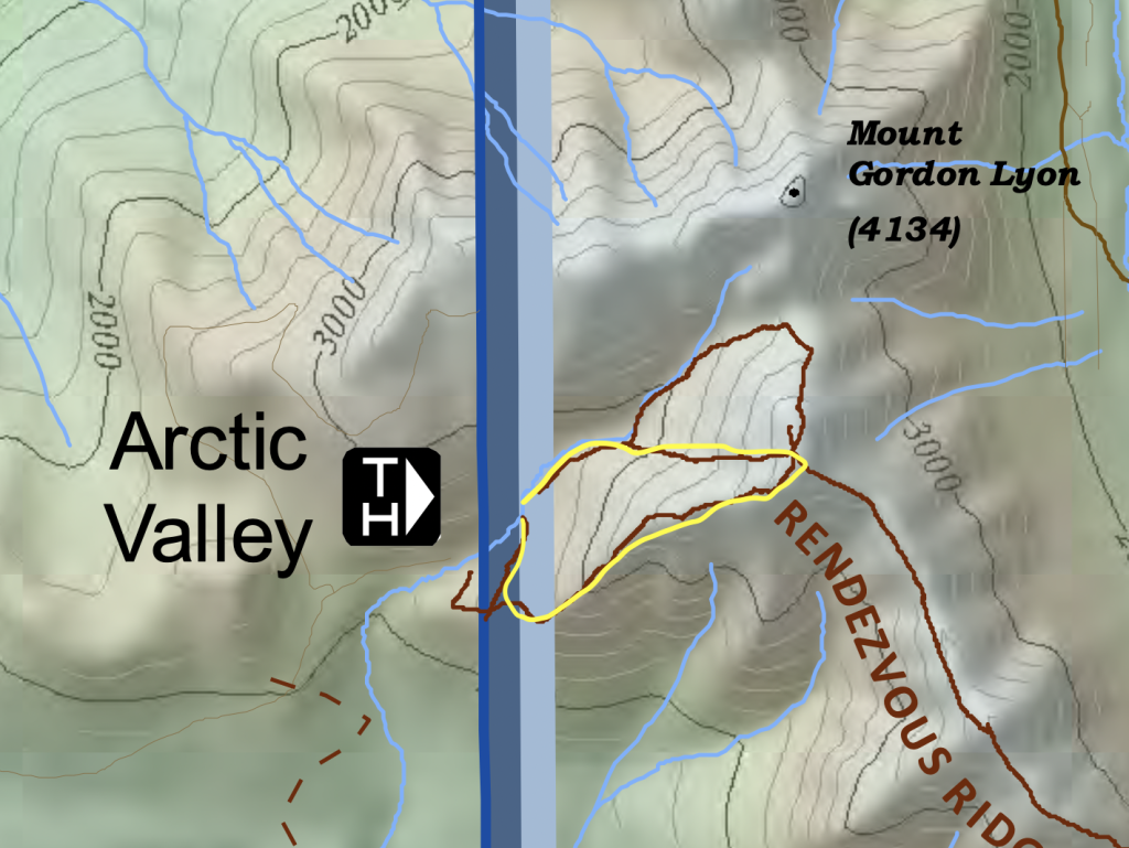
- Trailhead: Arctic Valley Trailhead
- Distance from Anchorage: Approximately 11 miles from downtown Anchorage
- Distance: 3.1 miles round-trip
- Elevation Gain: 1,500 feet
- Time: 2:30 hours
- Permit/Pass Required: Arctic Valley parking fees apply ($5)
5. Flattop Mountain Summit
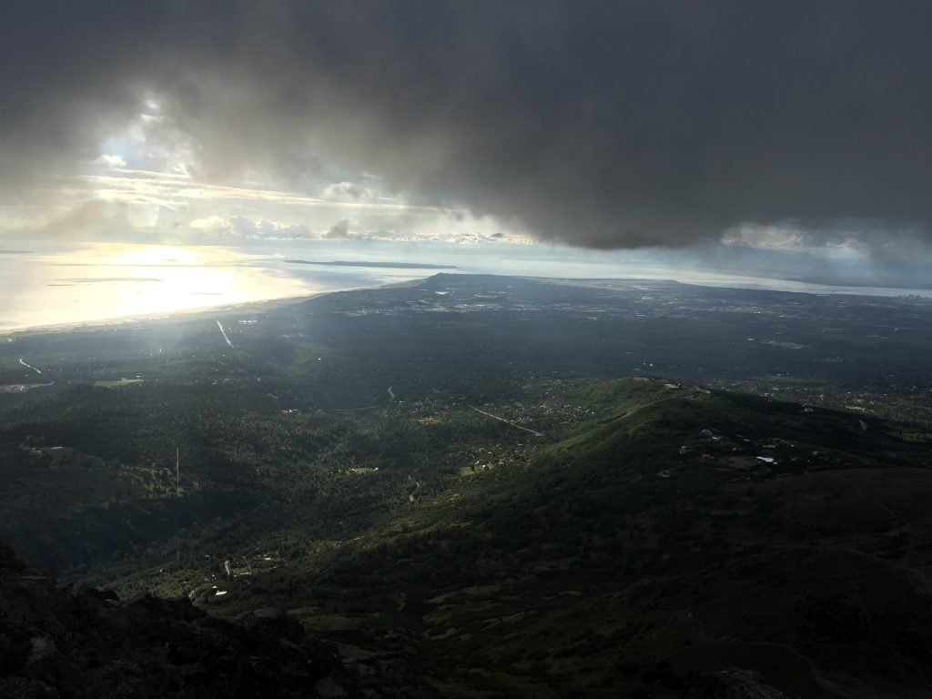
Oh Old Faithful. I listed this fourth just because everyone puts this first and I wanted to be contrarian. This is definitely the go-to hike if you want a super clear trail, epic views, and other people around. Don’t underestimate the difficulty though. It is steep and takes a bit of light scrambling at the top.
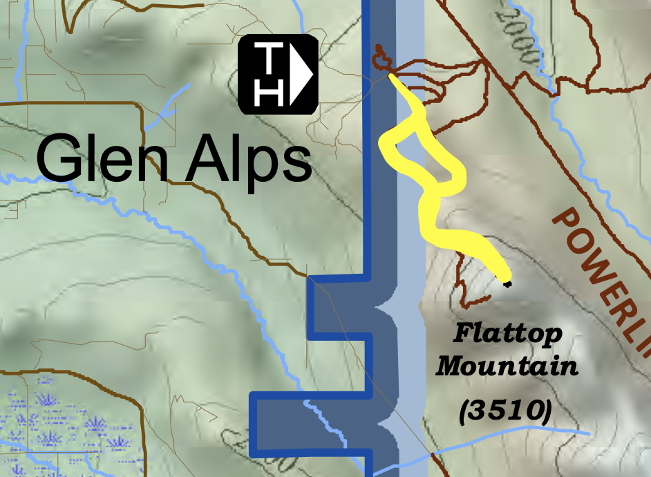
- Trailhead: Glen Alps / Flattop Trailhead
- Distance from Anchorage: Approximately 7 miles from downtown Anchorage
- Distance: 3.3 miles round-trip (partly a loop)
- Elevation Gain: 1,350 feet
- Time: 2-3 hours
- Permit/Pass Required: Annual Alaska State Park Pass ($60) or Day-use parking fee ($5) at Glen Alps / Flattop Trailhead.
The Best Challenging Hikes in Anchorage
1. Big O’Malley Peak
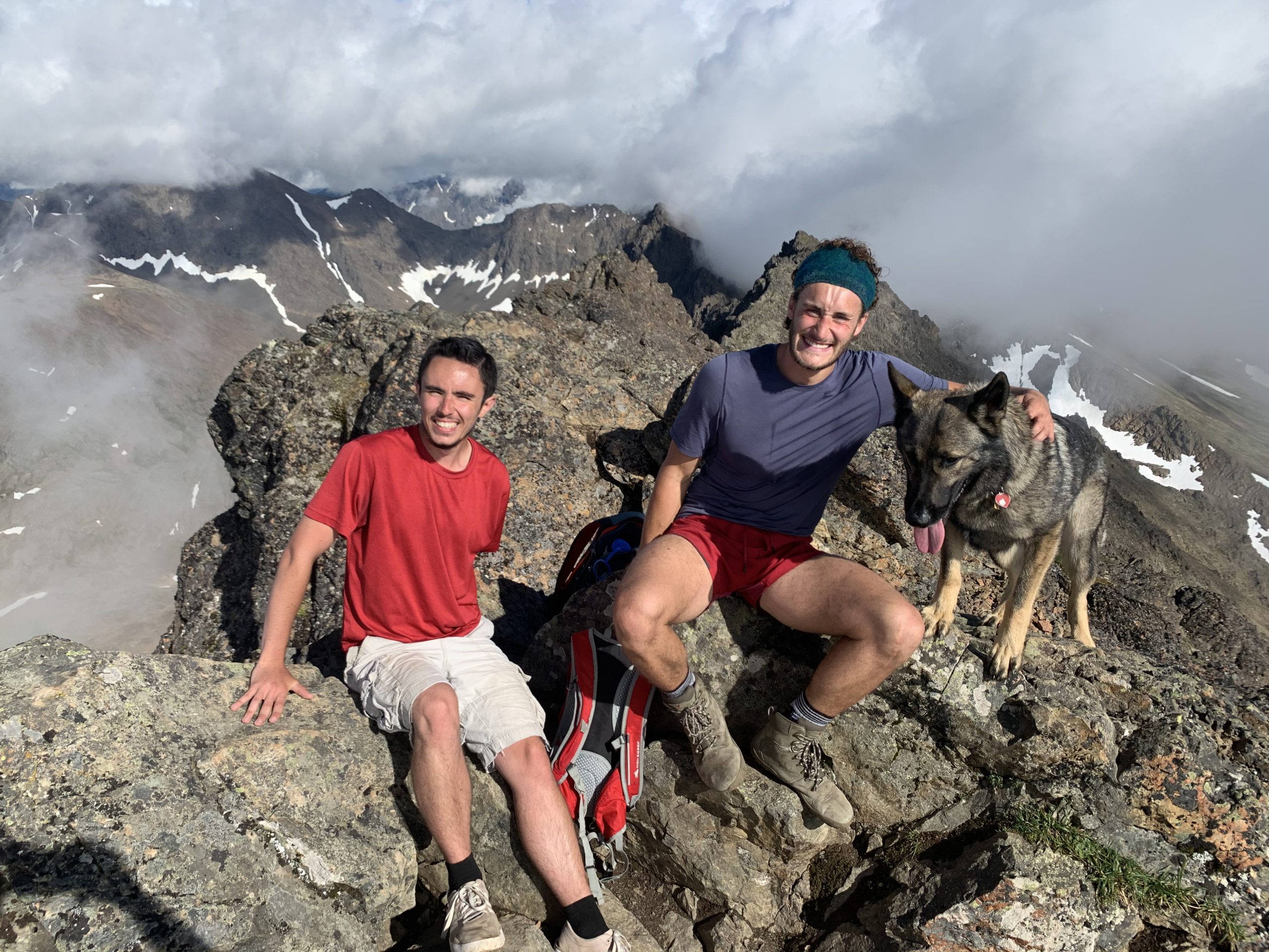
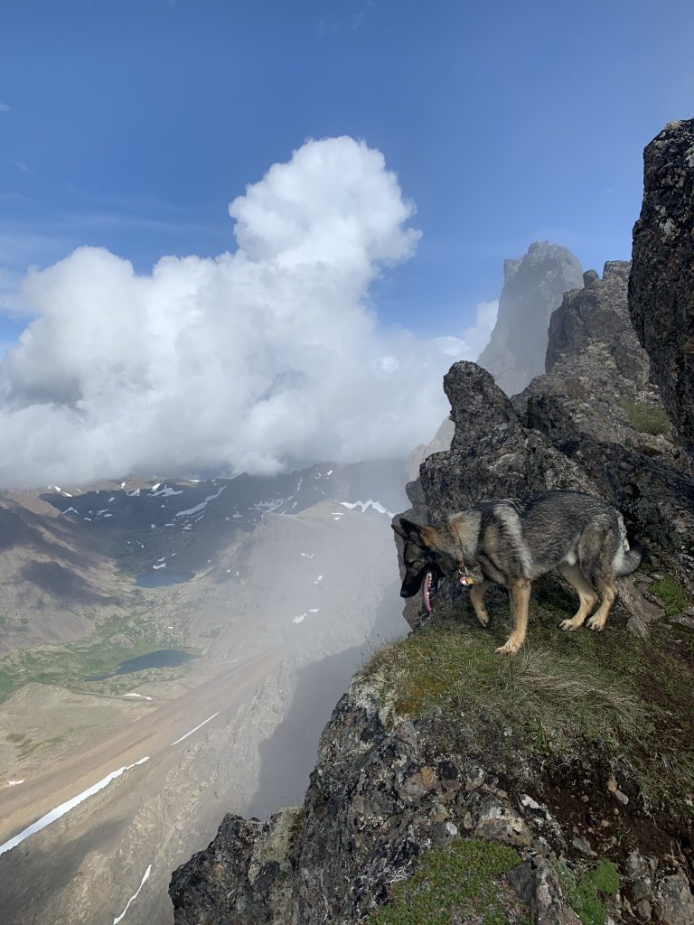
Big O’Malley is the tallest peak in the Chugach front range at 5150 feet. It’s extremely iconic within Anchorage as it is very recognizable from within the city. The hike itself is epic, essentially following the route to Little O’Malley and the Ball Park. Then, you take the trail up the Ball Park until you begin your scrambling along the slope of Big O’Malley.
It’s not a technical climb, but you certainly are scrambling a lot and doing some route finding near the summit. There are definite cliffs, but the route doesn’t require that you walk along them. Nothing is very dangerous, but it is exhausting, and you should be in good shape. The views are absolutely breathtaking from the top.
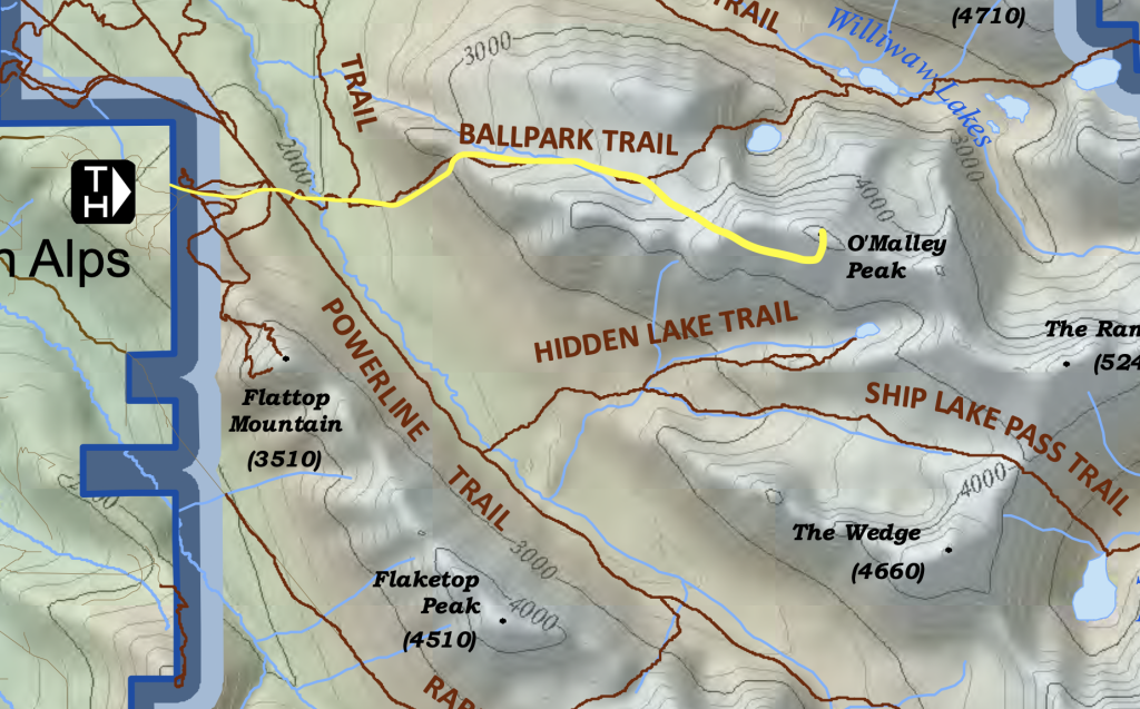
- Trailhead: Glen Alps / Flattop Trailhead
- Distance from Anchorage: Approximately 7 miles from downtown Anchorage
- Distance: 9 miles out and back
- Elevation Gain: 3300 feet
- Time: About 6 hours
- Permit/Pass Required: Annual Alaska State Park Pass ($60) or Day-use parking fee ($5) at Glen Alps / Flattop Trailhead.
2. Ptarmigan Peak
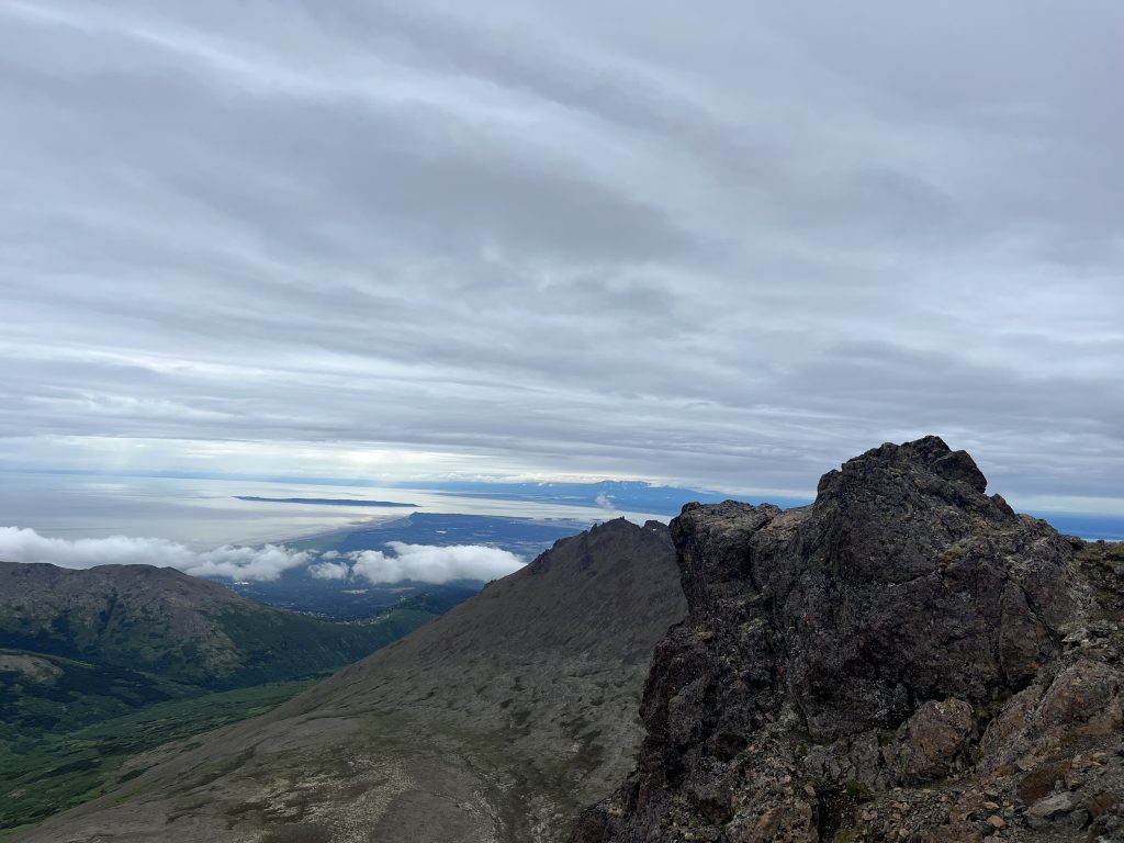
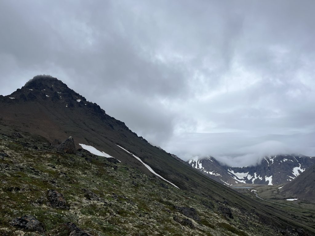
Ptarmigan is an epic climb, and is also considered to be one of the coveted peaks to bag in the Chugach front range. To climb this beast, you’ll essentially follow the trail to Rabbit Lake, before veering to the right to climb her. It’s a strenuous climb, but not dangerous. Just make sure you’re comfortable with some scrambling and route finding near the top. I love this mountain.
The views are incredible from the top.
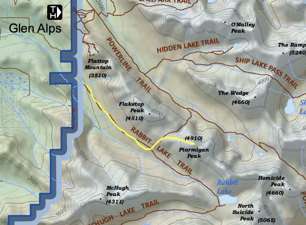
- Trailhead: Rabbit Lake Trailhead
- Distance from Anchorage: Approximately 11 miles from downtown Anchorage
- Distance: 7 miles out and back
- Elevation Gain: 3,000 feet
- Time: 5:30 hours
- Permit/Pass Required: No special permit required, but make sure to park alongside the road, not at the trailhead.
The Best Very Hard Hikes in Anchorage
Any of the hikes in my 2 day: 1 night backpacking guide can be turned into a single, arduous day hike.
Comparison Of Anchorage Hikes
| Hike Name | Difficulty | Trailhead | Distance | Elevation Gain | Time Estimate |
|---|---|---|---|---|---|
| Flattop Mountain Overlook Trail | Easy | Glen Alps / Flattop Trailhead | 1.5 miles RT | 400 feet | 1-2 hours |
| Rabbit Lake Trail | Easy | Rabbit Lake Trailhead | 8.7 miles RT | 1,500 feet | 4-5 hours |
| Symphony & Eagle Lakes | Easy | South Fork Valley Trailhead | 9 miles RT | 1,500 feet | 4-5 hours |
| Hidden Lake Trail | Easy | Glen Alps / Flattop Trailhead | 9 miles RT | 2,000 feet | 5 hours |
| Little O’Malley Peak | Moderate | Glen Alps / Flattop Trailhead | 4.5 miles RT | 1,500 feet | 3 hours |
| McHugh Peak | Moderate | Bear Valley Trailhead / McHugh Creek Trailhead | 5.6 miles (Bear Valley) or 5 miles (McHugh Creek) | 2,300 feet (Bear Valley) or 4,300 feet (McHugh Creek) | 4 hours (Bear Valley) or 6-8 hours (McHugh Creek) |
| Williwaw Lakes | Moderate | Glen Alps / Flattop Trailhead / Prospect Heights Trailhead | 10.1 miles loop, 11 miles RT, or 16.4 miles RT | 2,400 feet, 800 feet, or 1,200 feet | 6 hours, 8 hours, or 7:30 hours |
| Rendezvous Peak | Moderate | Arctic Valley Trailhead | 3.1 miles RT | 1,500 feet | 2:30 hours |
| Flattop Mountain Summit | Moderate | Glen Alps / Flattop Trailhead | 3.3 miles RT | 1,350 feet | 2-3 hours |
| Big O’Malley Peak | Hard | Glen Alps / Flattop Trailhead | 9 miles RT | 3,300 feet | 6 hours |
| Ptarmigan Peak | Hard | Rabbit Lake Trailhead | 7 miles RT | 3,000 feet | 5:30 hours |
Essential Tips for Hiking in Anchorage, Alaska
- Pack Smart: Always bring water, snacks, bear spray, and layers for changing weather. You can see my recommended packing list for Alaska day hikes.
- Check Trail Conditions: Alaska’s trails vary greatly depending on the season. Most of these hikes are only suitable in the summer months. Avalanches and snowy conditions complicate winter treks.
- Respect Wildlife: You might encounter moose and bears in the lowland sections of these hikes. I would recommend bringing bear spray and make a lot of noise when traveling through brush.
- Parking: For the most part, you’ll be able to find parking. The only one that is difficult sometimes is Flattop’s parking lot, but they’ve expanded it a lot recently so it’s pretty easy, even in peak hours. Do not park along the Flattop road though, they will ticket you here.
Conclusion
Anchorage has some of the best hiking options in all of Alaska. They’re extremely accessible and, since Alaska is so far north, you get above the tree line very quickly, leading to epic views. Feel free to comment or contact us if you have any questions or want a personal recommendation.
